
Fifteen years in the making, this catalogue will be an essential reference for bibliographers and archivists dealing with rare books and maps of the period, for map collectors, map librarians, and scholars and librarians working with early printed items and manuscripts.
The current image of the Spanish conquest of America and of the conquistadores who carried it out is one of destruction and oppression. One conquistador does not fit that image, however. A life-changing adventure led Cabeza de Vaca to seek a different kind of conquest, one that would be just and humane, true to Spanish religion and law, but one that safeguarded liberty and justice for the Indians of the New World. His use of the skills learned from his experiences with the Indians of North America did not always help him in understanding and managing the Indians of South America, and too many of the Spanish settlers in the Rio de la Plata Province found that his policies threatened their own interests and relations with the Indians. Eventually many of those Spaniards joined a conspiracy that removed him from power and returned him to Spain in chains.
That Cabeza de Vaca was overthrown is not surprising. His ideas and policies opposed the self-interest of most of the first Spaniards who had come to America. What is amazing is that he was able to inspire and hold support among many others in America, who remained loyal to him during his time in prison and after his return to Spain.
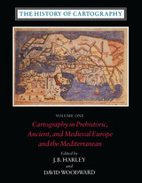
Volume One addresses the prehistorical and historical mapping traditions of premodern Europe and the Mediterranean world. A substantial introductory essay surveys the historiography and theoretical development of the history of cartography and situates the work of the multi-volume series within this scholarly tradition. Cartographic themes include an emphasis on the spatial-cognitive abilities of Europe's prehistoric peoples and their transmission of cartographic concepts through media such as rock art; the emphasis on mensuration, land surveys, and architectural plans in the cartography of Ancient Egypt and the Near East; the emergence of both theoretical and practical cartographic knowledge in the Greco-Roman world; and the parallel existence of diverse mapping traditions (mappaemundi, portolan charts, local and regional cartography) in the Medieval period.
Throughout the volume, a commitment to include cosmographical and celestial maps underscores the inclusive definition of "map" and sets the tone for the breadth of scholarship found in later volumes of the series.
"[The six-volume set] is certain to be the standard reference for all subsequent scholarship. The editors . . . have assembled and analyzed a vast collection of knowledge. . . . If the first volume is an indication, the complete set will be comprehensive and judicious." —John Noble Wilford, New York Times Book Review
"As well as enlarging the mind and lifting the spirits through the sheer magnitude of its endeavor, the collection delights the senses. The illustrations are exquisite: browsing fingers will instinctively alight on the sheaf of maps reproduced on stock slightly thicker than that of the text. The maps are so beguiling in the tantalizing glimpses they offer of other, seemingly incomprehensible, worlds, that the sight of them will stir the connoisseur in even the most-guarded scholar." —Ronald Rees, Geographical Review
"The corpus it brings to light, along with the extensive references, bibliography, and exhaustive appendices containing valuable comments about many of the pieces discussed, together make this book an important resource for the scholar."—Robert Provin, Professional Geographer
"This volume is a landmark of new research and will certainly contribute to further discoveries, translations, interpretations, inventories, more precise dating and the construction of stemmata." —Christian Jacob, Cartographica
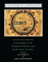
"In seeking to characterize the cartography of premodern Islamic and south Asian societies, the editors offer the image of an archipelago of cartographically conscious islands in a silent sea. The research potential which they have revealed is clearly vast and underappreciated, with many islands still to be discovered or enlarged. This important book, does more, therefore, than plug a huge gap in cartographic historiography. It provides the foundation for crosscultural cartographic research in two major world regions."-Jeffrey Stone, Ecumene
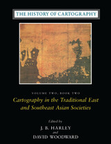
Volume 2, book 2, considers the cartographic traditions of China, Korea, Japan, Vietnam, Tibet, Burma, Thailand, Laos, Malaysia, Indonesia, Brunei, and the Philippines, presenting significant new research and interpretation of archaeological, literary, and graphic sources. Richly illustrated with forty color plates and over five hundred black and white illustrations, the book includes a number of rare and elaborate maps, many previously unpublished.
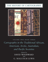
"The maps in this book provide an evocative picture of how indigenous peoples view and represent their worlds. They illuminate not only questions of material culture but also the cognitive systems and social motivations that underpin them" (from the introduction).
Although they are often rendered in forms unfamiliar to Western eyes, maps have existed in most cultures. In this latest book of the acclaimed History of Cartography, contributors from a broad variety of disciplines collaborate to describe and address the significance of traditional cartographies. Whether painted on rock walls in South Africa, chanted in a Melanesian ritual, or fashioned from palm fronds and shells in the Marshall Islands, all indigenous maps share a crucial role in representing and codifying the spatial knowledge of their various cultures. Some also serve as repositories of a group's sacred or historical traditions, while others are exquisite art objects.
The indigenous maps discussed in this book offer a rich resource for disciplines such as anthropology, archaeology, art history, ethnology, geography, history, psychology, and sociology. Copious illustrations and carefully researched bibliographies enhance the scholarly value of this definitive reference.
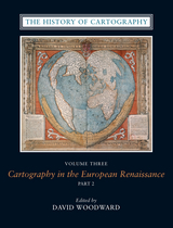
Cartography in the European Renaissance treats the period from 1450 to 1650, long considered the most important in the history of European mapping. This period witnessed a flowering in the production of maps comparable to that in the fields of literature and fine arts. Scientific advances, appropriations of classical mapping techniques, burgeoning trade routes—all such massive changes drove an explosion in the making and using of maps. While this volume presents detailed histories of mapping in such well-documented regions as Italy and Spain, it also breaks significant new ground by treating Renaissance Europe in its most expansive geographical sense, giving careful attention to often-neglected regions like Scandinavia, East-Central Europe, and Russia, and by providing innovative interpretive essays on the technological, scientific, cultural, and social aspects of cartography.
Lavishly illustrated with more than a thousand maps, many in color, the two volumes of Cartography in the European Renaissance will be the unsurpassable standard in its field, both defining it and propelling it forward.

The monumental Harvard Encyclopedia of American Ethnic Groups is the most authoritative single source available on the history, culture, and distinctive characteristics of ethnic groups in the United States. The Dimensions of Ethnicity series is designed to make this landmark scholarship available to everyone in a series of handy paperbound student editions. Selections in this series will include outstanding articles that illuminate the social dynamics of a pluralistic nation or masterfully summarize the experience of key groups. Written by the best-qualified scholars in each field, Dimensions of Ethnicity titles will reflect the complex interplay between assimilation and pluralism that is a central theme of the American experience.
This concise volume recounts the social and economic characteristics of successive waves of immigrants, where they settled, and how they achieved citizenship.


This book tells the story of twenty remarkable individuals, the country they transformed, and the University that helped them do it. There are many “firsts” in this book—first Chinese students at U-M, first female college president of China—and there are many “fathers” of disciplines: Wu Dayou, father of physics in China; Zheng Zuoxin, father of Chinese ornithology; Zeng Chengkui, father of marine botany.
While much has been written about these leaders and scholars in both English and Chinese, nowhere else is their collective story told or their shared bond with the University of Michigan celebrated.
The University of Michigan in China celebrates this nearly 200-year-old legacy.
READERS
Browse our collection.
PUBLISHERS
See BiblioVault's publisher services.
STUDENT SERVICES
Files for college accessibility offices.
UChicago Accessibility Resources
home | accessibility | search | about | contact us
BiblioVault ® 2001 - 2024
The University of Chicago Press


